It was the last weekend in December, and I wanted a hike but didn’t want the long drive.
“What if we walk Richmond’s floodwall?” I asked Andrew late the night before.
“Sure.” Ninety-five percent of the time he is willing to go along with any hike or camp I propose . . . unless I am overzealous on mileage . . . or I am too ambitious on skill level . . . or I am illogical on bear-sighting hopes. Okay, so maybe seventy percent of the time he goes on hikes or camps I propose. But the floodwall was the opposite of his concerns.
- This floodwall urban hike meant walking almost seven miles
- The floodwall itself though stretches for a little over three miles, bordering and protecting portions of the City of Richmond from high waters
- It should be ranked a low One of Five difficulty
Not only this, but the floodwall showcases the city’s small but mighty skyline and the James River’s powerful currents. Sadly, all of this beauty is one we rarely seek for our own advantage . . . until now.
Here’s our urban trail story of Richmond’s floodwall, told primarily through pictures . . .

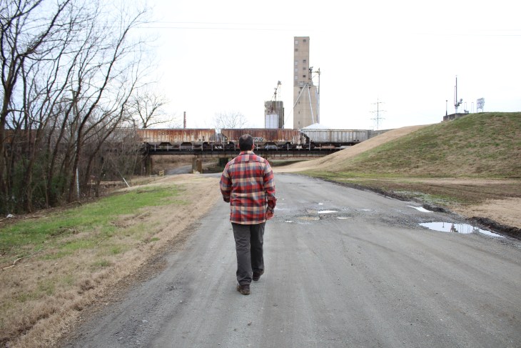
Slipping under the train track’s rusty frames and the downtown expressway’s swooping exit ramps, we follow the lazy brown canal towards the river.


Once we made it to the river, we crossed the Mayo Bridge and stumbled above this massive snapping turtle that had to have been two feet long.
 Glancing back at the city, we kept walking, looking left and right at the industrial-type of view over the water . . .


Soon, it was time to say goodbye to the Mayo Bridge and turn east towards Brown’s Island where a portion of the floodwall stood before us . . .


Here, the east portion of the floodwall ended but we slipped under a dark overpass to explore further . . .


Circling around the other side of the wall, we took a sneaky back way to return to the Mayo Bridge. Meanwhile, trains steamed overhead with cars in brilliant colors.

A few moments later and we arrived at an abandoned factory.

 Here, the colors popped and appeared more vibrant due to the overcast day . . .
 Beside the factories, intricate murals were splayed on the ground while others stretched to the tops of buildings . . .


Reaching the other end of the Mayo Bridge, a short walk moved us closer to the top of the wall, now moving west. A blue heron, seeking little fish in runoff from the river, met us before flying a few yards away only to pause again.

At the top of the floodwall, incredible city views shined next to the brown river . . .


The rapids raged as we followed the winding floodwall towards Brown’s Island. Geese perched on barely visible rocks with one leg tucked. Meanwhile, both white water rafters and kayakers slid by in vessels of colors.


At the end of the floodwall, we chose to dart under interstate ramps and over train tracks to keep walking towards Brown’s Island . . .


There, a new bridge was recently built. This memorial bridge connects parts of Richmond (Manchester to Brown’s Island) and honors a senior planner at the city’s Department of Planning and Development Review. That man — T. Tyler Potterfield — worked to make this dream bridge a reality but passed away before its completion.


 The path for pedestrians and cyclists rests above an early twentieth century dam and provides amazing views of the city’s skyline as well.


Along the bridge squeezed between the wooden walkway boards are quotes from people who were present when Richmond — the capital of the Confederacy — fell to the Union army during the American Civil War. A plaque goes on to say that these words were said by both witnesses and participants as the city was evacuated by Confederates and as Richmonders — who were previously enslaved — gained their freedom.

Heading back to where we started, we chose to make a loop and amble along the canal. Here, city buildings with restaurants and apartments look over the water while a splash of murals appear on the right.

 And this is Richmond, our Richmond — a big little city (as residents say), one that boasts of its river so much the area is nicknamed “The River City.” Strangely enough though, all my life I’ve wanted to move far away from this place and it is only since I’ve met Andrew that I have seen it anew, that I have found an appreciation. I have seen the city grow, I have seen it redefine itself, and I have felt it become home.
Walking back I was smiling, thinking of how each time I tend to lack enthusiasm for urban hikes. If asked any day, a hike to me means sweat and dirt and pain — real muscle-and-mental pain — due to a mountain climb. However, I forget a hike is simply a long walk and I can get that here — in a city where there is a skyline and murals and sidewalks. This type of hike is also beautiful — in a different way of course — but on a day like this one, that beauty is very much acknowledged.
A bit of brightness on a bleak day ! I wished we’d spent more time exploring Richmond ! Midad. X