It was forecast to be a rainy weekend in the mountains . . . again . . . but we were still hopeful. Each morning, we set our alarm clock then checked the weather, waiting with anticipation for there to be news that the clouds would break to let sunshine in. Unfortunately, that never happened.
“What about the weather in Richmond?” I asked Andy after we checked the weather once more early Sunday morning. He investigated. “It’s supposed to rain later this afternoon but for now, it appears to be holding off.” That was it — all we needed to determine we could pack our small packs and head towards the James River in the city.
We had found two river hikes earlier and were holding out for a day, just like this one, where we were prevented from traveling to the mountains to enjoy a trek through the forest. This is where I’d soon learn that sometimes this river hike is just a grand as a walk through the woods. Here’s more on the one we did:
- Twelve-point-four mile circuit
- 160-foot elevation gain
- Two of Five difficulty rating
Since the elevation and difficulty level were low, we decided to increase the distance, doubling the hike’s length to over twelve miles. As you may know by now, normally when we choose to challenge ourselves past what is originally planned, this would mean a troubling story follows: one that details how we were nearly mauled to death by bears or how we were one inch from being perpetually lost in the wilderness or even how we were about to perish due to a lack of water. Fortunately, none of this happened. The good news about choosing city hikes is that there are no bears or expansive forests, and water — along with a variety of other restaurant drinks — is plentiful and just around the corner. Because of this, dear reader, you are left with essentially one of our first tranquil hikes and that means it will be told primarily through pictures.
Our path started on a sidewalk adjacent to raised train tracks.

 Paralleling this, a foggy canal, which we followed to the river.

 From there, we followed the grey under the train tracks towards the heart of the city.
 Quiet Spring was barely visible, pushing slowly up through the earth and blossoming on limbs.


Soon, the city’s pipeline was in sight. Slipping down the thin metal ladder, we walked on the grate above the pipeline, which slowly began to disappear under the high James River waters.


 High waters mean strong rapids. Flashes of bright orange could be seen under the surface as geese and duck feet paddled furiously in the opposite direction. They tried to brave the force but were carried away with the current.


Close to the end, the James River rushed over the pipeline with waters so high and strong that we were forced to turn back and find another route.
Passing an area of murals, we soon made it to Brown’s Island.


As we approached the Tredegar Iron Works — the start of our initial James River Hike — the train approached and slow-chugged past.
 Walking under the train trestle, we continued towards Richmond’s famous suspension bridge, which hangs underneath the Lee Bridge.


The bridge is half a mile long and links to Belle Isle where our hike ignored the Belle Isle loop and instead headed straight towards the southside pedestrian bridge.


There, we saw a beautiful blue heron that stood with its beak open until it spread its wings and flew towards an abandoned building, landing on the muddy river’s edge.


From there, we headed down the Low Water Trail, only to learn that too was impassable due to high waters. Secretly, I liked that we had to keep backtracking. Because we were on a river hike, I thought there was nothing better than having a river so high and powerful that the water surged over our trail.
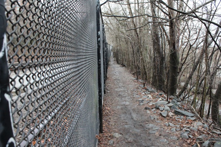
 Turning back, we took the High Water Trail. Initially it wasn’t quite as scenic due to the fact that it was bordered by this chain-link fence.
 However, our path soon opened to a bit of woods with the trees so vibrant, I could have mistaken the season for autumn.


 As we walked, I cut invasive vines from the trunks of choking trees then took the English ivy, Oriental Bittersweet, Wintercreeper, more and wove them into a wreath. This act reminded me both of my past and future: The past with my Papa on his farm, where my sister and I would stand for what felt like hours, watching him cut woody vines dangling from high tree limbs before twisting them, delicate in his large calloused work-hands, into wreath after wreath. Once he would get them started, he would pass them to my sister and I, cutting more vines and handing them to us; but our little hands, too quick and eager, kept breaking the vines so that our wreaths had more sharp corners than smooth twists.
But my future, I saw that too as my engagement ring sparkled with my moving fingers: Me, making a smaller wreath for our wedding. Those vines, ones we wove together during trails like this, creating a crown that I would wear above my head in lieu of a veil for our bohemian-ish wedding — outside, maybe in the mountains beside a trail leading to a overlook.
 Carrying our wreath with us, we darted on cutaway trails toward the river’s edge.
A little over a mile later, our High Water Trail came to an end beneath the Boulevard Bridge.

 Crossing railroad tracks, we climbed up to the top of the bridge before strolling down its walkway. There, the milky brown waters of the James stretched around us and small flocks of Canadian geese honked above our heads.


 Walking far above railroad tracks, we headed towards the Northbank Trail, which took us out of the woods and into civilization.


 Here, we passed the first of three cemeteries before walking through a neighborhood.
 Lead by Richmond’s skyscrapers, we walked beside a passing train, cars brimming with coal. Here, we headed towards the city, to the end of our hike.


Many times, I believe the word ‘hiking’ is synonymous for ‘mountains’ — mountain trails, cliffs, rocks, overlooks. Often I forget the true definition of a hike, and that is simply ‘a long walk.’ Over twelve miles later, with sore feet and aching legs, Andy and I came to the end of our quickly-decided hike. As if on cue, the clouds opened and began to release a drizzle of rain. I looked down at our boots splattered with thick clay and brown mud.
 It made me realize we don’t have to travel to the mountains for hikes. Some days, it’s okay to take a different path because there is beauty everywhere. You just have to look.
Hi Bezzy, Another lovely tale of a lovely walk ! Looking forward to reading the next one.. Best wishes,, Midad. xx
Hi, medad! It was a lovely walk and thank you so much for reading! Talk to you soon xoxo